Dixie Valley Overview
UNR geologists have been studying Dixie Valley since the 1954 Fairview Peak and Dixie Valley earthquakes; much work has been done to understand the nature of faulting, and subsequently, the geothermal systems in Dixie Valley. A formal project was initiated in August 2010 to study geothermal potential in Dixie Valley, with a focus on Naval Air Station (NAS) Fallon land.
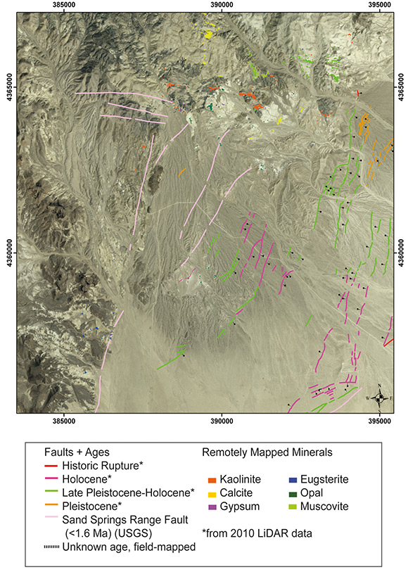
LiDAR data and low sun-angle aerial photography were used to identify fault traces. Field work was done to map surficial geology and verify the fault traces. Following preliminary analysis of ASTER satellite remote sensing data, HyMap hyperspectral data were collected over large sections of Dixie Valley and processed using an automated mapping method. GBCGE investigators validated and adjusted mineral maps.
An exploratory trench was excavated across a scarp, but this feature exhibited no stratigraphic offset and was determined to be an erosional feature. 2 m temperature surveys were conducted in two areas of Dixie Valley and identified possible new geothermal anomalies. Joint modeling of gravity and magnetic data in the Dixie Meadows region is underway to characterize local geothermal structural controls.